Analysing the English item maps
The process of mapping the English items and accession entries has allowed the research team to analyse several different aspects of the collections. The main Englishness site hosts many detailed articles about individual items in the collections, but alongside this, the mapping process has allowed closer analysis of the spread of accessioned items. This page provides two different approaches to looking at the collections: by accession year, and by English time period.
English items by Accession Year
The Quicktime movie on the right shows the geographic spread of English items as they were accessioned by the museum. When the museum opened in 1884 there were a total of 2,627 recorded entries for items from England in the museum archives. Since that time, the English collections have grown considerably, and the archives list 26,475 entries for items from England.
The number of English items added to the collections has varied greatly from year to year - in some years (1977 and 1979) no English items were accessioned, whilst in others a significant proportion of the English collections were added to the museum's catalogue. For example, in 1921, 3,473 entries were added to the archives, accounting for over 13% of the English collections in a single year.
Other years which saw the arrival of significant numbers of items from England include 1938 (620 entries, 2.3% of the current total), 1940 (667 entries, 2.5% of the current total), 1951 (857 entries, 3.2% of the current total), 1966 (799 entries, 3% of the current total), and 2007 (2,593 entries, 9.8% of the current total).
Since the museum opened, an average of 213 entries referring to English items have been added to the archives each year.
Accessioned items by time period
Accession entries in the museum's database contain details of the time period from which the accessioned item or items date. The process of mapping the database for this project has allowed the research team to generate separate maps showing the spread of accessioned items by time period. The maps for the accessioned items by time period are as follows: Paleolithic (700,000BC - 10,000BC), Mesolithic (10,000BC - 4,500BC), Neolithic (4,500BC - 2,500BC), Bronze Age (2,500BC - 700BC), Iron Age (700BC - 500AD), Middle Ages (500AD - 1499AD), 16th Century, 17th Century, 18th Century, 19th Century, 20th Century, and 21st Century.
Accessioned items by item type
Alongside the detailed information about each item in the museum's database, there are a series of keywords which categorise the accessioned objects, allowing the collections to be divided by item type. As part of the Englishness project a number of sample maps for different keywords have been produced. These maps examine the collections of axes, firearms, fossils, ornaments, religious items, and tools.
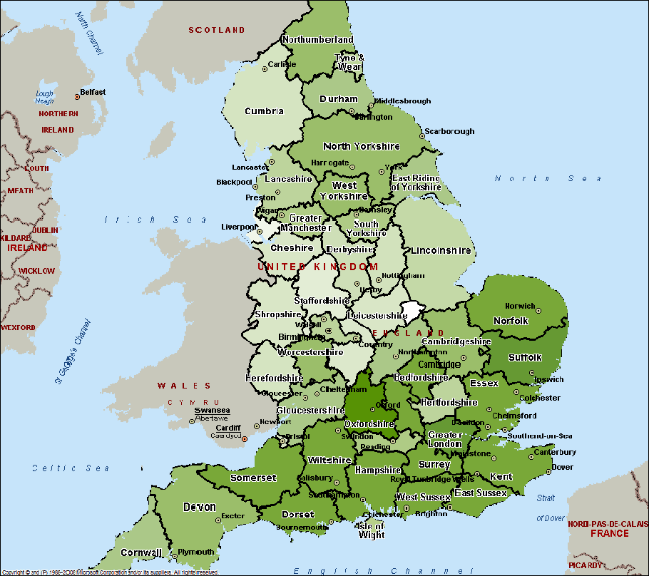
Accessioned items by ceremonial county
The map shown below provides an illustrative view of the number of accession records for each ceremonial county, with the darker counties having more accession records than those with lighter shading.